The predicted reprieve from heavy rain and flooding across swathes of NSW is unlikely to eventuate yet, with only the state’s far west expected to be spared from afternoon thunderstorms.
Lismore in the state’s north copped more than 100mm in two hours on Wednesday afternoon, with the SES performing five flood rescues in just over an hour.
The downpour in Lismore comes as the Bureau of Meteorology issued a fresh warning for severe thunderstorms, with swathes of the state expected to be hit.
The warning zone stretches for almost the entire state – from Mungindi near the Queensland border to Tumbarumba near the Victorian border.
Almost the entire coast will also be hit, with BOM issuing a separate warning for residents of the South Coast and parts of the northern rivers and the Snowy Mountains.
They’re expected to be hit with heavy rain, but it looks like they will escape the thunderstorms.
Only the state’s far west will be spared the drenching which has been causing havoc for days.
Rock slides, bridge closures and even a yawning sinkhole in a residential Coffs Harbour street have been caused by the extreme weather event.
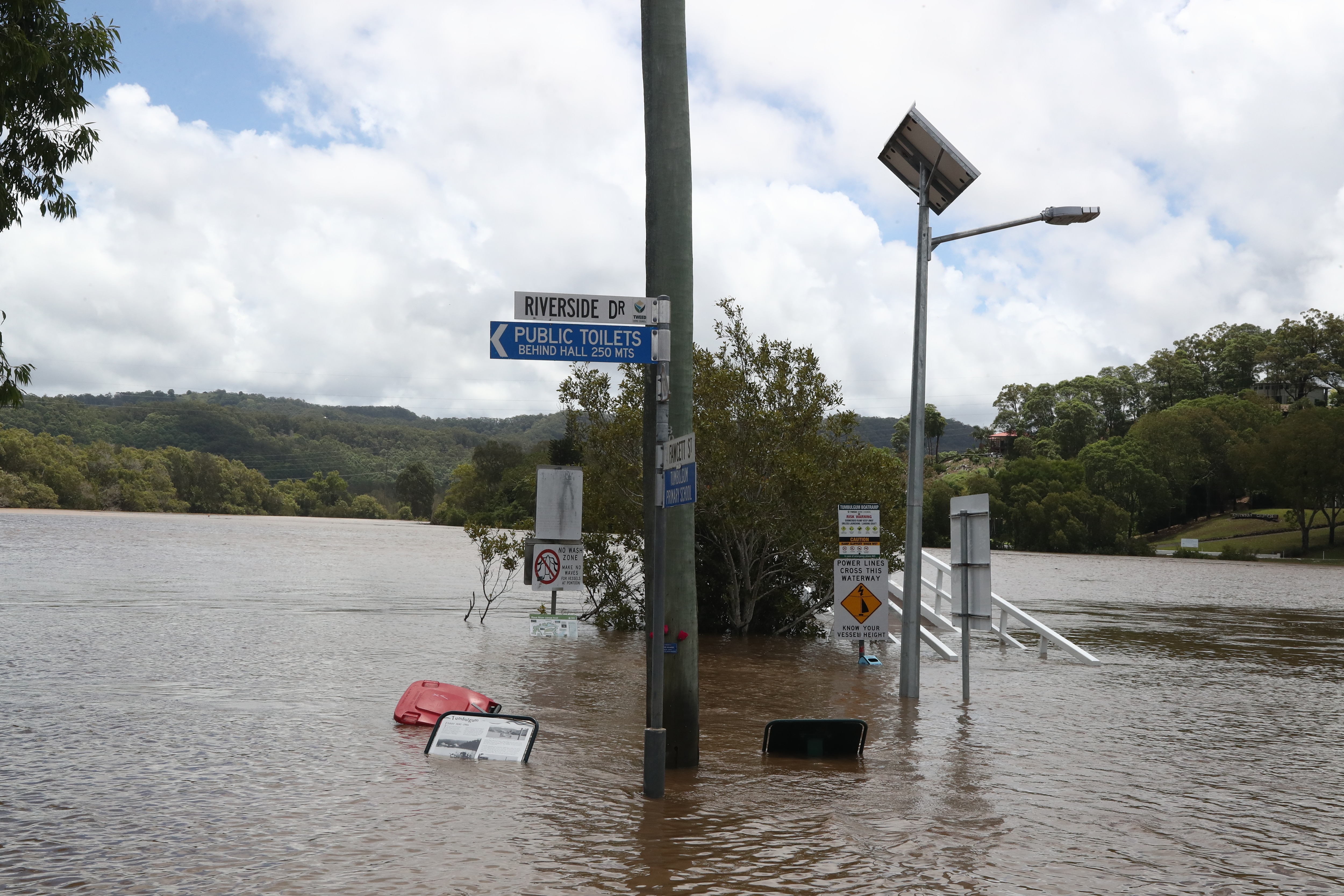
The deluge has also prompted widespread flooding around the northern rivers, with evacuation orders remaining in place in Condong and Tumbulgum, north of Murwillumbah.
The order came after the Tweed River burst its banks near Tumbulgum on Tuesday, with minor to moderate flooding in the area.
An SES spokesperson told AAP teams were assessing the infrastructure in the area, and the order won’t be lifted until they give the all clear.
Evacuation warnings are also in place for south Murwillumbah and north Macksville.
Flood warnings for the Tweed, Hastings, Nambucca and Camden Haven rivers have been downgraded after their peaks, but there is still a risk of flooding for a swag of other rivers down the coast.
The Macleay River is expected to peak in Kempsey around 6pm on Wednesday, with the SES anticipating that low lying areas, roads and bridges will be impacted.
Floodwaters in Grafton, Ulmarra and Maclean along the Clarence River are expected to peak with the high tide around midday.
Inflows from the Orara River combined with a high tide are expected to cause renewed flooding in the three towns on Thursday morning.
The Orara River has also peaked in Glenreagh at moderate flooding levels.
Downstream Coutts Crossing is expected to experience moderate flooding with the river forecast to peak near 10.5m on Wednesday evening.
Areas around Coutts Crossing may become inundated and isolated, the SES has warned.
Further south, minor flooding is still occurring in Bellingen and Thora, but river levels are falling.
With floodwater flowing in from the Wilsons River, Coraki at the confluence of the Richmond River is expected to flood after midday.
Bungawalbin Junction and Woodburn are also expected to flood.
A number of roads across the affected regions have been closed, and authorities are urging drivers to be careful.
The SES attended more than 300 jobs overnight and has performed more than 30 flood rescues since the extreme weather began on the weekend.
Since the downpours began on Saturday, the SES has attended more than 1900 jobs.
“The majority of those jobs are fixing leaking roofs and damage due to heavy rainfall or trees down due to strong winds and we’re also getting requests for sandbags,” an SES spokeswoman said.


